What we do >>> Cartographical production for selling
Atlas of oil and gas fields of Khanty-Mansiysk Autonomous Okrug-Yugra
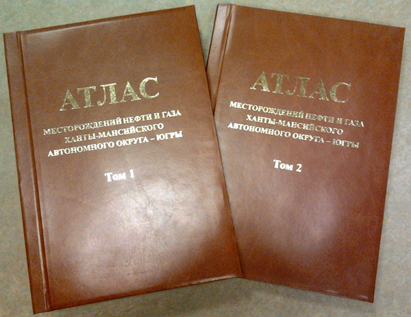
The Atlas of oil and gas fields of KhMAO-Yugra is a unique edition (collection, album), presenting a brief characteristic of 464 oil and gas fields, discovered over last 60 year period of prospecting and exploration and commercial exploitation of petroleum accumulations at the KhMAO-Yugra territory.
Data on the fields are given according to the State balance of oil and gas and subsoil licensing as on 01.01.2012. Information is unified by field’s pertaining to elements of tectonic and oil geological zoning of the territory. Characteristics of productive sediments and parameters of accumulations differentiated according to valid regulations. Deposits distribution of objects of a geological cross section is realized by an oil geological sectional layering accepted at the time of hydrocarbon resources re-estimation.
Oil and gas fields have been discovered throughout the territory of Yugra with the exception of the western-most and the eastern-most areas: from Iusskoe gas and oil field in the west to Borovoe oil field in the east; from Karabashskoe, Zimnee and Yuzhno-Gavrikovskoe in the south to Pokhromskoe, Verkhnenadymskoe and Bakhilovskoe in the north of the autonomous okrug. Oil content is revealed over a wide strata range of a geological cross section, including pre-Jurassic complex (Devonian organogenic limestone, Triassic igneous-sedimentary deposits, regolith of Paleozoic shale), the whole Jurassic period, Neocomian, Vikulovskaya (the Aptian Age), Pokurskaya (the Albian-Cenomanian Age), Ipatovskaya (the Comiacian-Santonian) formations.
Data on fields and deposits of the Atlas are structured by oil-and-gas bearing regions and districts. Before every oil-and-gas bearing region data there is a fragment of a tectonic map and a fields’ map with elements of oil geological zoning in the Atlas.
As a tectonic base “Tectonic map of the central part of the Western Siberian Plate under the editorship of V.I. Shpilman, N.I. Zmanovskiy, L.L. Podsosova” (1999) is used in the Atlas. Oil and geological zoning corresponds with “Pattern of oil and geological zoning of the West Siberian oil and gas province under the editorship of I.I. Nesterov (junior), A.B. Shpilman, Ya.E. Faybusovich, O.I. Suprunenko, V.S. Staroseltsev (2010), a stratigraphic confinement of deposits corresponds with the regional stratighaphical sectional plane of Jurassic and Cretaceous deposits (1991 and 2004).
The atlas shows data on every field’s location according to the administrative, tectonic and oil geological zoning, a discovery time, a hole-discoverer, discovered productive objects, organizations prepared potential targets for prospecting works, as well as those which discovered and prepared a field for development, a subsoil user and a field condition on the date of Atlas preparation for publication.
Data on a tectonic structure of traps for oil, a geological cross section, oil-and-gas bearing complexes and indexing of productive beds are given in the Atlas.
A description of a deposit structure, including a depth of occurrence, deposit’s measurement, location of fluid and gas-liquid contacts, and dimensional orientation of fields is presented for the biggest objects. But in case of multilayer fields the same information is given for some objects of different geological structure or depending on belonging to oil-and-gas complexes. Graphic illustration of such deposits is given, including an estimation plan, geologic-geophysical characteristics of basic productive beds based on core material study and development survey as well as a geological cross section with coverage of maximum oil and gas column.
Lithologic-petrographic and facial characteristics of oil-and-gas content deposits, average values of effective hydrocarbon saturated layers, porosity, penetrability and a hydrocarbon saturation of reservoirs are given. Having enough information, pattern of area’s changing of oil and gas saturated layers and filtrational – capacious properties are described. Data on commercial productivity of deposits based on results of testing and investigation of exploratory wells are presented.
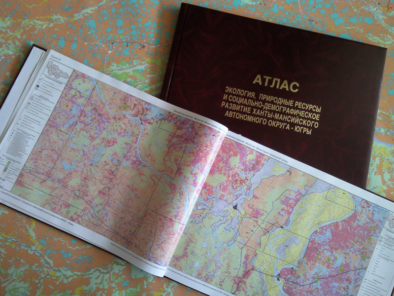
Atlas of Environmental Ecology, Natural Resources and Social-Demographic Development of KhMAO-Yugra
The Atlas is prepared by materials of Autonomous Institution “V.I. Shpilman Research and Analytical Centre for the Rational Use of the Subsoil”, administrations of KhMAO-Yugra’s municipalities, Department of Ecology of KhMAO-Yugra, Subsurface Resources Management Department of KhMAO-Yugra, Federal Service for State Registration, Cadastral and Cartography of KhMAO-Yugra, Federal State Unitary Enterprise “Roslesinforg “Zapsiblesproject”, State Institution “Khanty-Mansiysk Centre for Hydrometeorology and Environmental Monitoring”. Results of remote sensing data interpretation of high resolution were used while compiling of the Atlas.
The data are given in an integrated form and described an anthropogenic activity, natural resources, the current structure of land-use and the current system of specially protected natural territories on the date of Atlas preparation.
A volume one of the Atlas contains 125 A2 sized pages. The volume consists of 3 maps:
- Map of cadastral division of the KhMAO-Yugra’s land, the scale is 1: 2 500 000,
- Map of location of KhMAO-Yugra’s forestries, the scale is 1: 2 500 000,
- Map “Land-use. Environmental ecology. Natural resources monitoring”, the scale is 1:200 000, the number of pages is 114.
The Atlas shows the structure of land-use by land categories. The lands of forest fund are presented with forest compartments indexing and predominant forest tree, agricultural enterprises – with user name index.
As a result of remote sensing data interpretation and according to official material sources of negative impact on environment (torches of associated gas burning, water ejectors of sewage treatment plants, solid and industrial landfills, oil and produced water spills, logging areas, burned-out forest) were mapped.
The state of the natural environment is monitored at three levels in KhMAO-Yugra, illustrated in the Atlas by environmental monitoring sites visualization systemized by level and natural environment components. For the first time the biggest system of environmental monitoring covered the whole region are showed, including towards 6 thousand environmental monitoring sites.
The Atlas includes the detailed data on transportation and industrial infrastructure, such as over 500 facilities of treatment and oil and gas transport, at about 13 thousand indexed multi-well pads, over 500 flare facilities.
License blocks for production and exploration of hydrocarbons, widespread mineral deposits and solid commercial minerals are allocated.
Atlas “Geological structure and oil-and-gas content in the Neocomian complex of the Khanty-Mansiysk Autonomous Okrug-Yugra”
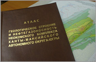
The Atlas “Geological structure and oil-and-gas content in the Neocomian complex of the Khanty-Mansiysk Autonomous Okrug-Yugra” under editorship of A.V. Shpilman, G.P. Myasnikova, G.I. Plavnik. It is prepared by team of National Enterprise of Khanty-Mansiysk Autonomous Okrug-Yugra “V.I. Shpilman Research and Analytical Centre for the Rational Use of the Subsoil”.
An editorial drafting group consists of V.A. Volkov, V.N. Goncharova, V.G. Eliseev, E.V. Oleynik, T.V. Rubina, E.V. Ryb’yakova, L.A. Solopakhina, N.V. Sudat, L.G. Sudat, E.A. Teplyakov, V.M. Yuzhakova.
“Atlas” is a result of the Neocomian deposits geological and geophysical survey, carried out in National Enterprise of Khanty-Mansiysk Autonomous Okrug-Yugra “V.I. Shpilman Research and Analytical Centre for the Rational Use of the Subsoil”.
“Atlas” comprises 6 sections.
An atlas section 1 “General geological characteristics and oil-and-gas content of the Neocomian complex’s deposits”. A short history of exploration state for the Berriasian – Lower Aptian deposits of KhMAO’s sedimentary mantle and contiguous areas is given. The section comes with series of maps: seismic and drilling investigations of the target; KhMAO’s tectonic map (references to numerous tectonic elements are given in the text); structural maps for main reflecting interfaces (J) (the Malm) and (K) (the Lower Aptian), between them there are hydrocarbon bearing features of the Berriasian – Lower Aptian age. Two regional profiles are given: a time cross section along regional geologic cross-section R10 and R11 including stratification and picking of seismic reflection interfaces in the Lower Cretaceous and regional geologic cross-section of the Neocomian deposits along a seismic line R10 and R11. A geological zoning of oil fields map for the whole sedimentary mantle of KhMAO territory and a general map of fields are given too. A high fields’ density in the central (inner) part of the tectonic region can clearly be seen. The geological zoning of oil fields approved for the whole sedimentary mantle in the Western Siberian oil-and-gas province and for the Neocomian complex is in sharp contrast to lithological and facies zoning of the Berriasian – Lower Aptian deposits approved for a stratigraphic sectional plane. The section is finished by deposit occurrence distribution pattern in the Neocomian oil-and-gas bearing complex showing that multilayer fields and oil pools are dominant at the Okrug territory.
In the atlas section 2 “Ground rules, procedure of oil-and-gas bearing targets identification in the Berriasian – Lower Aptian deposits profile (the Neocomian complex, sub-complexes, reservoirs)” following oil-and-gas bearing targets are identified based on cap rock investigations of structure and extension in the profile: the Neocomian complex, two sub-complexes (complicated and uncomplicated), clinoform reservoirs. Short geological characteristics of the targets, the Alymskaya sub-regional cap rock, the whole Neocomian complex and the uncomplicated Neocomian sub-complex are given. The Atlas section is illustrated by map of Alymskaya cap rock structure, model of the Neocomian oil-and-gas bearing targets structure, map of total thickness of the uncomplicated sub-complex.
In the atlas section 3 “Short geological characteristics of complicated sub-complex of the Neocomian oil-and-gas bearing complex” short lithological characteristics of the whole Neocomian oil-and-gas bearing complex, two sub-complexes within it (complicated and uncomplicated) and common factors of hydrocarbon accumulations distribution are given. The section comes with maps reflecting complicated sub-complex structure (total and net reservoir thicknesses). Maps with borders of clinoform reservoirs and their number are provided too.
The atlas section 4 “Geological structure and oil-and-gas content of the Neocomian clinoform reservoirs” deals with hydrocarbons accumulations structure and allocation within 11 clinoform reservoirs composed of the following beds, having a west direction dip of horizons: AS 7-9, AS 10-12, BS 1-7, BS 7-8, BS 10, BS 11-13, BV 4-5, BV 6-7, BV 8-9, BV 10, BV 11-13. Short geological characteristics of each reservoir are given which coming with series of maps: structural ones, total and net reservoir thicknesses, net reservoir thickness of the Achimov deposits, making the bottom section of reservoirs complicated. A schematic of avandelta’s system which was on the time of formation is given for the reservoir of BV 8-9 bed. Principal schematics of structure are given for the all reservoirs. Each reservoir has both the same characteristics in structure and a lot of individual peculiarities which set it apart from the others. Rock texture reflecting depositional conditions are given at the end of each reservoir description. Geological structure of the Achimov deposits and a deposit occurrence distribution pattern within them are considered. A map of structure and oil-and-gas content of the Achimov deposits is given.
In the atlas section 5 “Oil resources base of the Neocomian oil-and-gas bearing complex at the Khanty-Mansiysk Autonomous Okrug – Yugra territory” oil and gas reserves and resources, a structure of the Neocomian oil-and-gas bearing complex’s resources base are considered. A short historical reference to dynamics of resources base estimation of the Neocomian complex and methods used for resource estimation are given. Equations used for resources estimation are given as well as characteristics of standard sections, maps of density and diagrams of resources distribution.
In the atlas section 6 “Priority areas for oil and gas geological survey in the Neocomian complex” some recommendations on exploration of hydrocarbon accumulations in the Neocomian oil-and-gas bearing complex and targets made the complex complicated are given based on established geological structure distribution pattern, accumulations allocations and the calculation of resources density on the KhMAO area.
A number of pages are 193. A size of the pages is A3.
View a catalog in a new window
View a price list in a new window
How to order a required map or Atlas:
You can send a product order by e-mail: crru@crru.ru. Please, put a full title of Atlas or map on your product order. It is necessary to specify a map scale. Requisite details of your company are required. We will send an invoice for payment to your e-mail or a postal address. You can receive a product after payment. For more information, please call a reception office of Autonomous Institution "V.I. Shpilman Research and Analytical Centre for the Rational Use of the Subsoil" +7(3452)40-47-10, 62-19-01. After sending your product order by e-mail you can call us to hasten a process of receiving a required map or Atlas.